![](/images/other/stat-length.png)
![Trail Mountain bike Le Béage - Par les Sucs de Montfol et de la Lauzière - Le Béage - Photo](https://media.geolcdn.com/t/1900/400/ext.pjpeg?maxdim=2&url=https%3A%2F%2Fservices.sitytrail.com%2FGeolivesWS%2FDownloadMedia.ashx%3FTrailID%3D316997%26Media%3D16132_6.jpg)
Par les Sucs de Montfol et de la Lauzière - Le Béage
tracegps
User
![Length](/images/other/stat-length.png)
![Max alt](https://static1.geolcdn.com/siteimages/upload/files/1508320355ic_sort_altitude_max_24dp.png)
![Uphill gradient](https://static1.geolcdn.com/siteimages/upload/files/1508320355ic_sort_den_pos_24dp.png)
![Km-Effort](/images/other/stat-length.png)
![Min alt](https://static1.geolcdn.com/siteimages/upload/files/1508320355ic_sort_altitude_min_24dp.png)
![Downhill gradient](https://static1.geolcdn.com/siteimages/upload/files/1508320355ic_sort_den_neg_24dp.png)
![Boucle](https://static1.geolcdn.com/siteimages/upload/files/16400158638029165_repeat_loop_refresh_sync_direction_icon.png)
![Mountain bike](https://static1.geolcdn.com/sitytour/trail-icons/202.png)
3h00
Difficulty : Difficult
![Scan this QR Code to open this trail in the SityTrail application](https://capi.geolives.com/qq0zvz2zws4bq2lad0pu/sitytour/trails/316997/qr.png?size=200)
FREE GPS app for hiking
About
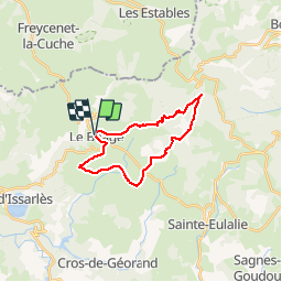
Trail Mountain bike of 19.5 km to be discovered at Auvergne-Rhône-Alpes, Ardèche, Le Béage. This trail is proposed by tracegps.
Description
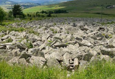
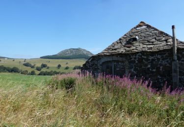
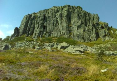
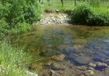
Grande et belle randonnée sur le plateau de la haute Ardèche, le parcours est très bien balisé. Quitter Le Béage par la D16, et monter à gauche pour accéder au plateau. Par le GR3 passer à Verden, Chazalés, puis avec GRP "Tour du Mezenc Gerbier" contourner le Suc de Montfol. Passer entre le Suc de Séponnet et le Suc de la Lauzière, rencontrer le GR7 et le quitter par la gauche pour le "Tour de la Montagne Ardéchoise" qui vous ramène au point de départ. Bonne rando à tous!
Positioning
Comments
Trails nearby
![Trail Walking Cros-de-Géorand - 2023-01-26_11h39m18_Le Béage-Tour des Sucs 15km.gpx.xml - Photo](https://media.geolcdn.com/t/375/260/6453586f-359e-4cec-ac7d-b8d2edfcbed0.jpg&format=jpg&maxdim=2)
![Walking Walking](https://static1.geolcdn.com/sitytour/trail-icons/101.png)
Walking
![](/images/other/stat-length.png)
![](https://static1.geolcdn.com/siteimages/upload/files/16400158638029165_repeat_loop_refresh_sync_direction_icon.png)
![Trail Walking Le Béage - suc du montfol et lauzière - Photo](https://media.geolcdn.com/t/375/260/d7f86ecc-e74b-4b11-a732-571b54443e1e.jpg&format=jpg&maxdim=2)
![Walking Walking](https://static1.geolcdn.com/sitytour/trail-icons/101.png)
Walking
![](/images/other/stat-length.png)
![](https://static1.geolcdn.com/siteimages/upload/files/16400158638029165_repeat_loop_refresh_sync_direction_icon.png)
![Trail Walking Le Béage - Le tour des cinq sucs au départ du Béage - Photo](https://media.geolcdn.com/t/375/260/c0574d3a-d54f-48f9-b08a-ab54d05d1368.jpg&format=jpg&maxdim=2)
![Walking Walking](https://static1.geolcdn.com/sitytour/trail-icons/101.png)
Walking
![](/images/other/stat-length.png)
![](https://static1.geolcdn.com/siteimages/upload/files/16400158638029165_repeat_loop_refresh_sync_direction_icon.png)
![Trail Walking Le Lac-d'Issarlès - Grand tour lac d'Issarlès - Photo](https://media.geolcdn.com/t/375/260/97ff9f11-f883-4bfc-9be1-40ea930c8a38.jpg&format=jpg&maxdim=2)
![Walking Walking](https://static1.geolcdn.com/sitytour/trail-icons/101.png)
Walking
![](/images/other/stat-length.png)
![](https://static1.geolcdn.com/siteimages/upload/files/16400158638029165_repeat_loop_refresh_sync_direction_icon.png)
![Trail On foot Le Lac-d'Issarlès - Le tour du Lac - Photo](https://media.geolcdn.com/t/375/260/0693bdf7-a39e-426d-8dba-718f752c6269.jpeg&format=jpg&maxdim=2)
![On foot On foot](https://static1.geolcdn.com/sitytour/trail-icons/100.png)
On foot
![](/images/other/stat-length.png)
![](https://static1.geolcdn.com/siteimages/upload/files/16400158638029165_repeat_loop_refresh_sync_direction_icon.png)
![Trail Walking Le Béage - Par les Sucs de Montfol et de la Lauzière - Le Béage - Photo](https://media.geolcdn.com/t/375/260/ext.jpg?maxdim=2&url=https%3A%2F%2Fservices.sitytrail.com%2FGeolivesWS%2FDownloadMedia.ashx%3FTrailID%3D316996%26Media%3D16132_6.jpg)
![Walking Walking](https://static1.geolcdn.com/sitytour/trail-icons/101.png)
Walking
![](/images/other/stat-length.png)
![](https://static1.geolcdn.com/siteimages/upload/files/16400158638029165_repeat_loop_refresh_sync_direction_icon.png)
![Trail Mountain bike Freycenet-la-Cuche - Tour du Tourte - Les Estables - Photo](https://media.geolcdn.com/t/375/260/ext.jpg?maxdim=2&url=https%3A%2F%2Fservices.sitytrail.com%2FGeolivesWS%2FDownloadMedia.ashx%3FTrailID%3D172619%26Media%3D13984_3.jpg)
![Mountain bike Mountain bike](https://static1.geolcdn.com/sitytour/trail-icons/202.png)
Mountain bike
![](/images/other/stat-length.png)
![](https://static1.geolcdn.com/siteimages/upload/files/16400158638029165_repeat_loop_refresh_sync_direction_icon.png)
![Trail Walking Freycenet-la-Cuche - Tour du Tourte - Les Estables - Photo](https://media.geolcdn.com/t/375/260/ext.jpg?maxdim=2&url=https%3A%2F%2Fservices.sitytrail.com%2FGeolivesWS%2FDownloadMedia.ashx%3FTrailID%3D172618%26Media%3D13984_3.jpg)
![Walking Walking](https://static1.geolcdn.com/sitytour/trail-icons/101.png)
Walking
![](/images/other/stat-length.png)
![](https://static1.geolcdn.com/siteimages/upload/files/16400158638029165_repeat_loop_refresh_sync_direction_icon.png)
![Trail Walking Le Béage - Tour de ouf du Montfol - Le Béage - Photo](https://media.geolcdn.com/t/375/260/ext.jpg?maxdim=2&url=https%3A%2F%2Fservices.sitytrail.com%2FGeolivesWS%2FDownloadMedia.ashx%3FTrailID%3D172385%26Media%3D13733_6.jpg)
![Walking Walking](https://static1.geolcdn.com/sitytour/trail-icons/101.png)
Walking
![](/images/other/stat-length.png)
![](https://static1.geolcdn.com/siteimages/upload/files/16400158638029165_repeat_loop_refresh_sync_direction_icon.png)